Seeded and Natural Orographic Wintertime clouds: the Idaho Experiment
The Seeded and Natural Orographic Wintertime clouds: the Idaho Experiment, SNOWIE, is a comprehensive observational and modeling research program to address longstanding uncertainties regarding the effectiveness of orographic winter precipitation enhancement through glaciogenic cloud seeding. The overarching goal is to understand the natural dynamical and microphysical processes by which precipitation forms and evolves within orographic winter storms and to determine the physical processes by which cloud seeding with silver iodide (AgI), either from ground generators or aircraft, impacts the amount and spatial distribution of snow falling across a river basin.
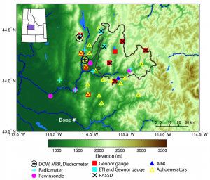
The field campaign was conducted from January 7 through March 17, 2017in the Payette Mountains of Idaho, north of Boise (Figure 1). The program was sponsored by the National Science Foundation (NSF) and Idaho Power Company (IPC). The program team consisted of NCAR investigators, IPC personnel, and investigators from the University of Wyoming, University of Illinois, University of Colorado, and and Boise State University.
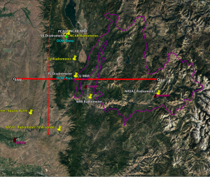
The comprehensive observational facilities deployed for SNOWIE included:
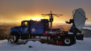
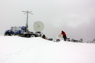
- 2 Doppler on Wheels (DOW) mobile radars (Figure 2)
- The University of Wyoming King Air (UWKA) research aircraft equipped with cloud microphysical probes and airborne remote sensing platforms, including a W-band cloud radar and lidar
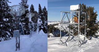
- High-resolution snow gauges (Figure 3)
- Atmospheric soundings to measure the thermodynamic profiles of the atmosphere
- Microwave radiometers, to measure the liquid water in the atmosphere (Figure 3)
- Vertically-pointing Ka-Band radars (Micro Rain Radar, MRR)
- Disdrometers
- Remote Area Snow Sampling Devices (RASSD) to sample snow in time-resolved intervals for trace chemistry studies
- An Acoustic Ice Nucleus Counter (AINC)
Twenty-four Intensive Observation Periods (IOPs) were conducted during SNOWIE. The cases were mostly focused on aircraft-based seeding, with a few focused on ground-based seeding or natural (completely unseeded) clouds. The UWKA flew transects along the wind, while the seeding aircraft flew perpendicular to the wind, thereby allowing the wind to disperse the AgI over the Payette Basin (Figure 4). Each seeded IOP included a UWKA research flight leg in the natural cloud before cloud seeding began, and the UWKA continued to fly transects in the clouds along its designated flight track during and after seeding. Preliminary data from the campaign found unambiguous signatures of seeding in the DOW and Wyoming Cloud Radar data.
The UWKA obtained in situ measurements in these radar-observed cloud seeding signatures to complement the radar data. Detailed observational analyses will be conducted coupled with high-resolution model simulations of the IOPs to try to understand and quantify the effects of cloud seeding on these winter orographic clouds.
